You’re ready to buy land and build. But wait. One step comes first. Land surveys tell you what you actually have. Not what you think. What’s really there?
A survey measures your property lines. It checks for utilities. It shows the ground shape. It finds easements. For Michigan developers, this matters before you spend a dime.
This guide explains why surveys are crucial. It shows how to use them. And it tells you what you need to know for your next project.
Why Land Surveys Are the Foundation of Every Successful Project
A survey answers basic questions:
- Where does my property end?
- What’s already on the land?
- Where are the utilities?
- Can I build what I want?
Without this information, you make decisions blindfolded. Surveyors remove the blindfold.
Here’s what surveys show:
They mark property lines exactly. They find structures already built. They locate utilities underground. They identify easements (when others have rights to use your land). They show the land’s shape and slope.
Michigan has unique challenges. We have wetlands. We’re near the Great Lakes. Our soil is heavy clay. Winter is harsh. A survey documents all these issues. You learn them early. Then you can plan better.
Purchasing and Evaluating Property Before Development
You found the perfect lot. The price is good. The location works. Then the survey shows problems. Now you have a choice. Negotiate the price down. Or walk away.
This happens because surveys reveal what’s hidden.
Surveys show property boundaries and limits.
You think you know where your property ends. The survey proves it. In Michigan, old property lines sometimes don’t match current deeds. A survey settles the argument. It’s the legal proof.
Surveys reveal easements and encroachments.
Other people might have rights to use your land. A power company might own an easement for power lines. The city might own a drainage easement. A neighbor’s driveway might cross your property. These aren’t your problems to solve. But you need to know about them before you buy.
Surveys map what already exists.
Old buildings. Pavement. Foundations. Trees. Utilities. Fences. All of it. Zoning rules depend on what’s there. Building setbacks. Lots of coverage. Parking spaces. A survey shows if your project fits the rules.
Surveys reveal site conditions.
Is the land sloped? How much? Is it wet? Will water drain naturally? Are there rock deposits? Is the soil stable? Michigan’s wet springs and clay soils create problems. A survey shows these problems upfront. You can adjust your budget or project plan before you’re committed.
Smart developers survey first. They know the site. Then they buy with confidence.
Using Survey Data to Support Engineering and Site Design
You own the land. Now it’s time to design.
Engineers take survey data and create plans. These plans show how everything fits.
Site plans show the overall layout.
Where does the building go? Where is the parking? Where do utilities run? How far from property lines? A survey provides every measurement. The engineer uses these numbers to create accurate site plans.
Grading plans manage water and slopes.
Surveyors measure how high or low the land is. Engineers use these measurements to plan drainage. Water must flow away from buildings. It must reach storm drains or retention ponds. In Michigan, drainage is critical. Poor drainage causes flooding and foundation damage.
Utility plans show where everything connects.
Water. Sewer. Electric. Gas. They all go in the ground or overhead. Survey data shows where existing utilities are. New utilities must connect to public systems. Engineers use survey data to design efficient, safe utility layouts.
Compliance plans ensure projects meet rules.
Zoning codes have setback requirements. They limit how much of the lot you can cover. They require specific parking. Survey data confirms your site can meet these rules. Review agencies approve projects faster when they know the site works.
Accurate survey data saves money. Designers work faster. Reviews move faster. Construction problems decrease. This is why survey data is worth every penny.
How Surveys Guide Construction and Infrastructure Improvements
The survey moves from the office to the job site.
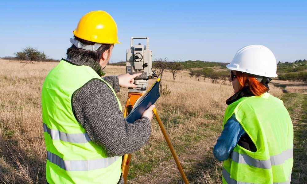
Construction crews need specific locations. Surveyors provide them.
Staking marks where to build.
Surveyors set stakes. These stakes show building corners. They show utility line locations. They show pavement edges. Construction crews follow these marks. Buildings end up in the right place. Utilities connect correctly.
Layout verification checks before major work starts.
Before digging foundations or laying pipe, the surveyor checks the site. Does the marked layout match the approved plans? Are utilities where they should be? Finding errors now costs less than fixing them later.
Building placement must be exact.
A building off by six inches might violate setback rules. It might hit an underground utility. It might create drainage problems. Surveyors ensure exact placement.
Utilities need precision.
Water lines must connect to public mains. Sewer lines must reach treatment plants. Gas and electric lines must align with utility infrastructure. Guessing creates failures. Surveyed locations prevent problems.
Quality control verification happens throughout construction.
Surveyors check progress regularly. Is the grading at the correct elevation? Are utilities at the right depth? Is the finished product matching approved plans? This verification prevents costly mistakes.
Michigan’s freeze-thaw cycles damage poorly built projects. Accurate surveying and construction prevent settling, cracking, and failure.
Supporting Long-Term Property Management and Future Development
The survey doesn’t end when construction finishes.
Subdivisions require survey data.
Want to sell half the property later? You need the survey. New deeds describe the new boundary. This boundary came from the survey. It’s legally defensible.
Easements need documentation.
A power company needs access for line maintenance. A neighbor claims a right-of-way. Your survey shows what agreements exist. It protects your interests.
Boundary maintenance prevents disputes.
Survey monuments decay over time. New surveys compare old monuments to current ones. This resolves boundary questions years later.
Future expansions start with the old survey.
Ready to build again on the same land? The old survey is your starting point. It shows what was there before. New surveys measure what’s changed. Design work moves faster with this baseline.
Redevelopment uses survey history.
Turning a parking lot into apartments? Converting a warehouse to offices? The original survey, combined with new measurements, informs safe redevelopment. You understand what you’re working with.
Michigan’s real estate market is active. Properties change hands. They get redeveloped. They find new uses. A documented survey history protects you and future owners.
Key Takeaways
Land surveys aren’t paperwork. They’re decision tools. They answer questions before money is spent. Before designs are finalized. Before construction starts.
For developers, remember:
- Always survey before buying land
- Use survey data when designing
- Trust surveyors to guide construction
- Keep surveys for future use
- Combine survey data with site investigations
The cheapest survey is the one done early. The most expensive survey is the one skipped.