If you have been searching for how much does it cost to subdivide land, you are not alone. In Grand Rapids, most subdivision projects cost between $8,000 and $75,000. The final number depends on your lot size, how many new parcels you need, and how close your property is to existing utilities.
What Is Land Subdivision?
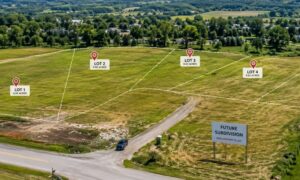
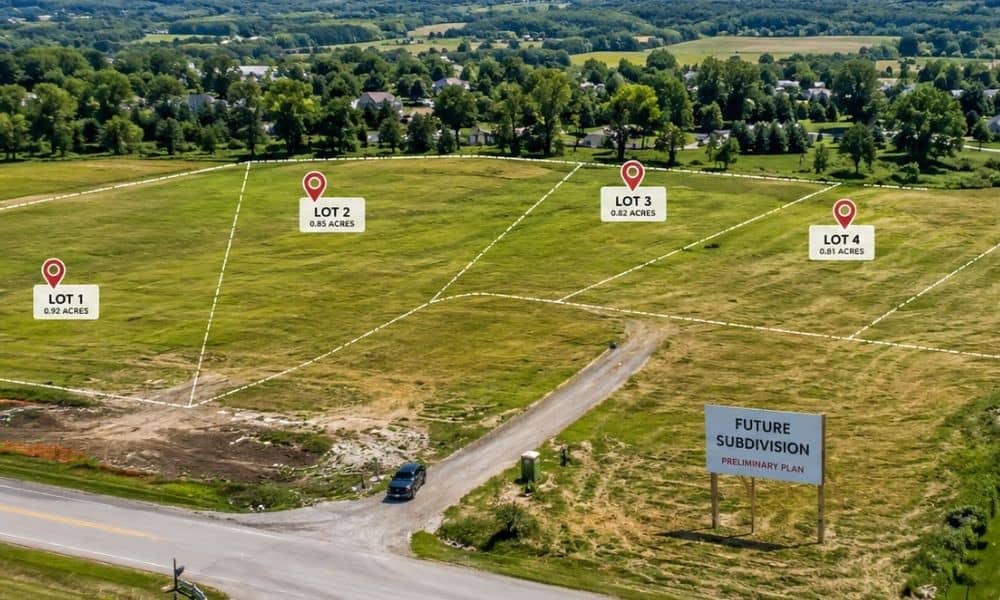
Land subdivision is the legal process of splitting one parcel of land into two or more separate lots. Each new lot gets its own legal description and property ID. In Michigan, the process follows the Land Division Act, Public Act 288 of 1967. It requires surveying, civil engineering, and approval from the city or county.
In Grand Rapids, all land splits must follow City zoning rules and Kent County requirements. You need a licensed surveyor, a civil engineer, and local approval before any new lots are legal.
How Much Does Land Subdivision Cost?
In Grand Rapids, Michigan, land subdivision costs between $8,000 and $75,000. Simple two-lot splits are on the lower end. Larger projects with utility extensions cost more. National averages range from $5,000 to $70,000, but local permit fees and engineering costs affect the final total significantly.
| Cost Category | Estimated Cost Range |
| Land Survey | $1,500 to $4,500 |
| Civil Engineering and Site Design | $3,500 to $15,000 |
| City Permit and Application Fees | $500 to $5,000 |
| Kent County Plat Recording | $200 to $800 |
| Legal and Title Work | $1,000 to $5,000 |
| Utility Extensions and Connections | $5,000 to $40,000 |
| Soil and Drainage Testing | $1,500 to $6,000 |
| Total Estimated Range | $8,000 to $75,000 |
The American Land Title Association reports that land survey costs for subdivision projects have risen 12 to 18 percent since 2022. Higher labor costs and equipment shortages are the main causes.
What Affects the Total Cost?
The biggest cost factors are the number of lots, distance from utilities, soil conditions, and local permit requirements. In Grand Rapids, road frontage rules and stormwater management requirements can add to the budget, especially for parcels near the Grand River or protected wetland areas.
Key factors that change your final cost:
- Number of lots: A two-lot split costs far less than a 10-lot plat needing full infrastructure design.
- Utility access: Extending water, sewer, or gas lines can add $20,000 to $40,000 or more to the total.
- Soil and drainage: Weak or poorly draining soil in West Michigan may need extra testing and engineered solutions.
- Environmental review: Lots near the Grand River or wetlands may need a Michigan DEQ review, which adds cost and time.
How Long Does It Take?
A simple two-lot split takes about 60 to 120 days. A full subdivision plat can take 6 to 18 months. Delays usually come from incomplete applications, public hearing schedules, or review backlogs at Kent County.
- Pre-application and surveying: 4 to 12 weeks
- Engineering and plan preparation: 6 to 16 weeks
- City review and public hearing: 4 to 16 weeks
- Final plat approval and recording: 4 to 8 weeks
The Michigan Society of Professional Surveyors says land survey turnaround times in Kent County now average 6 to 12 weeks. Starting the process early is essential.
Steps to Subdivide Land
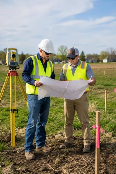
Subdividing land involves six main steps: confirm zoning eligibility, hire a surveyor and civil engineer, submit your application, get preliminary plat approval, complete required improvements, and record the final plat with Kent County.
Record the final plat. New lots are recorded with the Kent County Register of Deeds once approved.
Check zoning rules. Contact Grand Rapids Planning and Economic Development to confirm your lot meets size and frontage requirements.
Hire a licensed land surveyor. They prepare your boundary survey, legal descriptions, and plat drawing.
Engage a civil engineering firm. Engineers create grading plans, stormwater designs, and site plans for city approval.
Submit your application. File with the City of Grand Rapids Planning Department with all required documents and fees.
Attend public hearings if needed. Full plat subdivisions usually go through Planning Commission review.
Do You Need a Civil Engineer?
Yes, in most cases. Grand Rapids requires engineered site plans, grading designs, and stormwater management plans for subdivision applications. Hiring a civil engineer early prevents costly delays and keeps your application complete from day one.
A civil engineer will check drainage issues, review zoning rules, design utility connections, and prepare all required documents. They also work with your surveyor, attorney, and city staff throughout the process.
Cost Summary by Project Type
| Project Type | Estimated Cost | Timeline |
| 2-lot administrative split | $8,000 to $25,000 | 3 to 6 months |
| 3 to 5 lot subdivision | $20,000 to $50,000 | 6 to 12 months |
| 6 to 15 lot subdivision plat | $40,000 to $75,000+ | 12 to 18 months |
| Projects with utility extension | Add $10,000 to $40,000 | Varies |
| Projects with environmental review | Add $2,000 to $15,000 | Add 2 to 6 months |
Cost ranges reflect 2026 market conditions. Contact a licensed civil engineering firm for a project-specific estimate.
Frequently Asked Questions
How much does it cost to split land into two lots?
A two-lot split typically costs $8,000 to $30,000. The final amount depends on utility access and how much engineering review is needed.
Do I need a permit to subdivide land?
Yes. All land divisions require municipal approval and recording with the county Register of Deeds.
What is the Michigan Land Division Act?
It is Public Act 288 of 1967. It sets the rules for dividing land in Michigan, including lot size, access requirements, and local approval steps.
Can I subdivide land without a civil engineer?
For a simple boundary survey, a licensed surveyor may be enough. However, most Grand Rapids applications require engineering documents stamped by a licensed professional engineer.