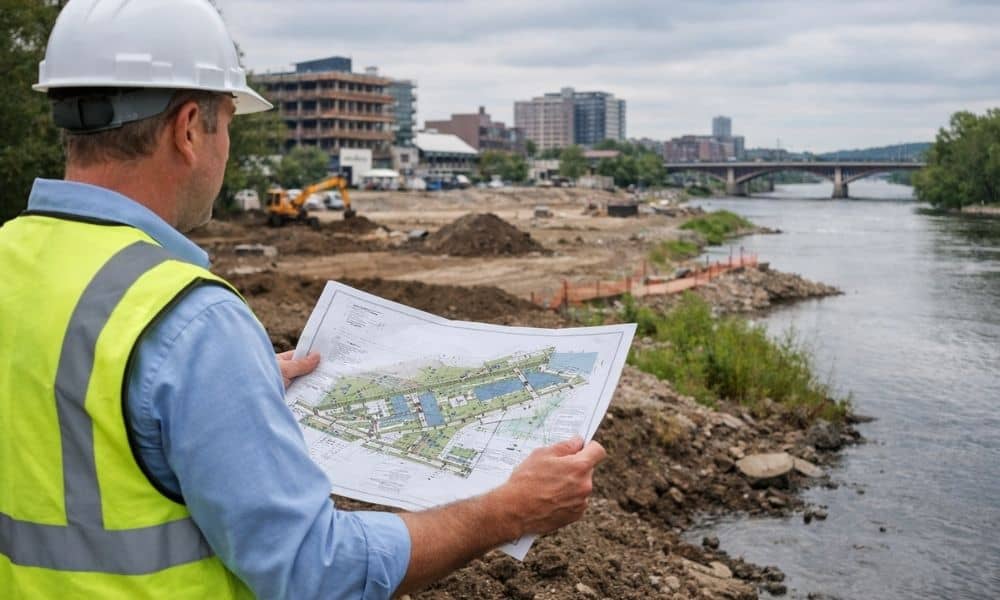
Riverfront land in Grand Rapids looks like a great place to build new homes, shops, and offices. The Grand River runs through the city and makes these areas feel valuable and active. At first look, these sites seem simple. The land is open. The location is good. Plans for new buildings can look easy to start. But riverfront land is not simple once work begins. The ground has a long past. The river changes how the land behaves. Old land use can leave problems that are not easy to see. This is where environmental engineering becomes very important.
What environmental engineering does in riverfront projects
Environmental engineering studies how land, water, and past land use affect building plans.
In riverfront redevelopment, it checks how the site works with the river and what is under the ground. It also looks at how old uses may still affect the land today.
A site can look empty but still have old waste or changed soil. It can also sit in areas where water moves into the ground in different ways. These things matter when building.
Environmental engineering helps show if a site is safe and ready for new work.
Hidden problems in riverfront land
Many riverfront sites were used long ago for factories, storage, or shipping work. Some of these uses are no longer there, but they leave traces behind.
There may be old fuel in the soil or materials buried underground. Some soil may have been moved or filled in over time. Groundwater may also carry things from past land use.
These problems are not easy to see by just looking at the land.
Environmental engineering helps find these issues early so they do not cause trouble later.
How the Grand River affects the land
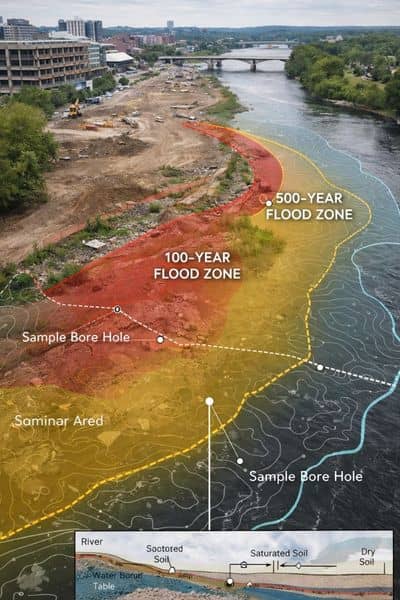
The Grand River plays a big role in how nearby land behaves. Water from the river can change how wet the soil is. It can also change how strong the ground feels.
When the river rises, water can move into nearby soil. When it drops, the soil can dry and shift. These changes affect how safe it is to build heavy structures.
Even small changes in water level can matter. Environmental engineering studies these changes before construction starts.
Flood areas limit building plans
Many riverfront sites are in flood zones. These are areas where water may rise during storms or heavy rain.
Flood zones come with rules. Some parts of the land may not allow buildings. Other parts may need to be raised higher. Some areas may not allow digging below ground.
These rules cannot be changed easily. They are set to keep buildings safe from water damage.
Environmental engineering helps teams understand these limits before design work goes too far.
More than one group checks riverfront projects
Riverfront projects don’t go through approval all at once. They move through different reviews, and each group looks at the site in its own way.
City teams focus on land use. State agencies look at environmental safety. Water groups pay attention to how the river could be affected.
These reviews often happen at different times, so feedback comes in pieces. One change can come in while another group is still reviewing the plans.
Environmental engineering helps keep everything aligned. It makes the site details easier to understand across all groups. That process usually starts with something as basic as a boundary survey for redevelopment, just to make sure everyone is looking at the same site limits from the start.
Plans can change after review
Even if a project looks ready at the start, changes often happen after environmental checks.
Some parts of the land may not be safe to build on. Some areas may need cleanup. Other parts may need to stay open or untouched.
When this happens, building plans must change. Buildings may move. Site layouts may shrink or shift.
Environmental engineering helps guide these changes so the project still works.
Why early checks save time and money
Many problems in riverfront projects happen when site issues are found too late.
If environmental engineering is done early, teams can see problems before full design work begins. This helps avoid major changes later.
It also helps developers understand what the land can support. This makes planning clearer and reduces surprises during approval or construction.
Early work does not remove risk, but it shows risk before it becomes costly.
Riverfront building depends on real land conditions
Riverfront land near the Grand River has strong value. But it also has hidden limits.
The river changes how soil and water behave. Old land use leaves marks underground. Rules from different agencies affect what can be built.
Environmental engineering brings all of this together. It shows what is really possible on the site.
Good planning depends on real conditions, not just first impressions.