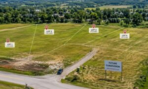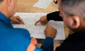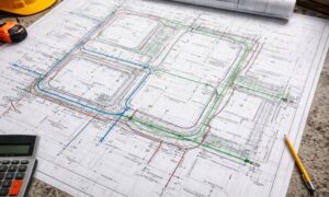

Stormwater design plays a bigger role in projects than many developers expect. In places like Grand Rapids, it can affect approvals, schedules, and construction costs. While it may seem like a small detail, stormwater design often shapes how a project moves from planning to construction.
Why Stormwater Design Gets Extra Attention on Road Projects
Road projects work differently than private site developments. When a road collects runoff, that water affects drivers, nearby properties, and downstream systems. Because of this, stormwater design for roads receives closer review.
In Michigan, agencies expect stormwater systems to last for many years. Roads must handle heavy rain, melting snow, and freeze-thaw cycles. As a result, engineers must plan for long-term performance, not just current conditions.
In Grand Rapids, this matters even more. Older neighborhoods, limited space, and aging infrastructure leave little room for error. Strong stormwater design helps protect roads, nearby buildings, and local waterways.
Where Stormwater Design Fits in the Roadway Planning Process

Stormwater design does not happen at the end of a project. Instead, it starts early, often at the same time engineers plan the roadway layout.
During early planning, engineers look at:
- Road alignment and width
- Curb placement and slopes
- Existing drainage paths
- Space for pipes and inlets
These early choices control how water moves across and away from the road. Once the layout is set, drainage options become limited. Because of this, late changes often cause redesigns and delays.
For developers, this step matters even when projects include both roads and private sites. If roadway drainage fails, site plans often need changes too.
How Roadway Geometry Shapes Stormwater Design
Roadway geometry and stormwater design depend on each other. One always affects the other.
For example, road slopes guide water toward inlets. Curb lines control where runoff enters the system. Even small grade changes can cause water to pool or flow too fast.
When roadway layout ignores drainage needs, problems appear quickly. Water may collect at intersections, flow toward private property, or overload pipes. Fixing these issues later costs time and money.
In Michigan, engineers also plan for snowmelt. During spring thaw, runoff behaves differently than summer rain. Stormwater design must handle both without damaging the road or nearby land.
Why Roadway Stormwater Reviews Take Longer
Many developers are surprised by how long roadway stormwater reviews take. The main reason is coordination.
Road projects often involve:
- State transportation agencies
- City or township engineers
- County drainage authorities
- Utility providers
Each group reviews stormwater design for different reasons. One checks discharge rates. Another looks at downstream impacts. A third reviews maintenance responsibility.
Because of this overlap, even small design changes can restart reviews. Engineers with Michigan experience know how to coordinate early, which helps reduce delays.
Construction-Phase Stormwater Issues on Road Projects
Stormwater design does not stop once construction begins. In fact, many problems appear during this stage.
Temporary drainage often causes the most issues. As crews build roads in phases, runoff paths change. Without planning, water can damage the base, wash out slopes, or flood nearby areas.
Inspectors often review stormwater items early. They check slopes, inlets, and erosion controls before paving starts. If problems appear, crews must fix them before moving forward.
Good stormwater design reduces these issues. It gives contractors clear plans and limits changes in the field.
How Stormwater Design Affects Project Schedules and Costs
Stormwater design affects more than drainage. It also affects the project timeline.
When drainage plans change late, other parts of the project must adjust. Road grades may shift. Utilities may move. Contractors may need more time.
On the other hand, early stormwater planning supports smoother construction. It helps teams coordinate work and avoid redoing tasks. For developers, this means better cost control and fewer delays.
In Grand Rapids, where construction seasons are short, timing matters. Projects that stay on schedule often share one thing: early stormwater design planning.
What Developers Should Do Before Roadway Design Begins
Developers can take simple steps to avoid stormwater problems.
Start by asking clear questions early:
- How will roadway drainage connect to nearby systems?
- Are there known flooding issues nearby?
- Who reviews stormwater plans for this project?
Next, work with a civil engineering firm that understands roadway projects. Local experience helps engineers plan designs that meet review standards the first time.
Finally, treat stormwater design as a planning decision, not a last step. When it guides early layouts, it supports faster approvals and smoother construction.
Stormwater Design Is a Planning Tool, Not Just a Requirement
Stormwater design does more than move water. In Michigan, it shapes how roads and sites work together over time.
For developers, strong stormwater design protects schedules, budgets, and long-term performance. It also builds trust with agencies and nearby communities.
When engineers address stormwater early and clearly, projects move forward with fewer issues. That approach turns a requirement into an advantage—and helps developments succeed from the start.