If you’re planning to build, one step matters more than almost anything else: soil testing. Before you pour a foundation, pave a driveway, or design a stormwater system, you need to know what’s under the surface. The soil may look solid, but without testing it, you’re guessing. And in construction, guessing leads to cracks, sinking, or costly rebuilds.
Why Soil Testing Matters
Grand Rapids is a city built on variety. Some areas sit on sandy soils near the river. Others rest on clay that swells and shrinks with rain. In a few spots, builders run into organic layers like peat or muck that compress under weight. Each type of soil reacts differently when loaded with a house, commercial slab, or roadway.
If you skip soil testing, you risk foundation problems later. Imagine building a warehouse on sandy soil that shifts when it gets wet. Floors crack, walls tilt, and repairs cost far more than the original test would have. Testing removes the guesswork so engineers can design the right foundation from the start.
Local Standards and Rules You Should Know
In Michigan, the Building Code requires geotechnical reports for many types of structures. In Grand Rapids, soil stability also connects directly to stormwater rules in the Unified Development Ordinance (UDO). That means site plan reviewers often look for a full picture of the property — both the boundaries from a land survey and the soil testing data that confirms drainage, grading, and erosion control plans.
In short, the city doesn’t just care about how your building stands. They also want to know how your land handles water, especially during the 25-year storm event. Together, survey information and soil tests give reviewers the evidence they need to approve your design.
West Michigan’s Soil and Water Challenges
Building comes with unique conditions. Here are the common soil types you’ll find:
- Sandy soils: Common near the Grand River. Good drainage, but poor at holding heavy loads without deep footings.
- Clay soils: Found in low-lying areas. They expand when wet and shrink when dry, causing movement under foundations.
- Glacial till: A mix of sand, gravel, and clay left by glaciers. Strong overall, but unpredictable from one lot to the next.
- Organic soils: Found near wetlands. Compressible, unstable, and usually unsuitable for direct building.
Now add rainfall to the mix. Grand Rapids has seen heavier storms and more frequent flooding in recent years. Wet soils lose strength. If your design doesn’t account for high groundwater or poor drainage, foundations can shift or fail.
The Step-by-Step Soil Testing Process
So what actually happens during soil testing? Here’s the typical workflow for a project in Grand Rapids:
- Preliminary study
Engineers review maps, old boring logs, and floodplain data. This helps predict what conditions the site may have. - Field borings
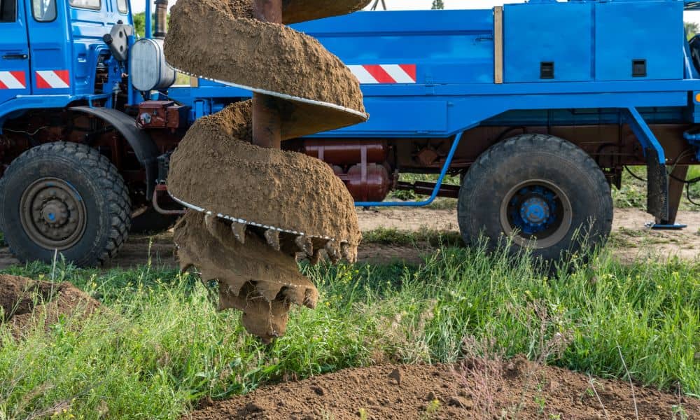
A drilling crew takes samples at different depths, often 10–20 feet down. These samples show the soil layers and groundwater level. - Lab testing
The samples are analyzed for moisture, strength, grain size, and plasticity. These tests reveal how the soil will behave under load. - Engineering analysis
A geotechnical engineer compares soil strength with the planned building loads. They recommend footing depth, foundation type, and drainage measures. - Final report
The results are written into a report. This document becomes part of the site plan package for the city. It also guides contractors in excavation and foundation design.
Common Problems When Soil Testing Is Skipped
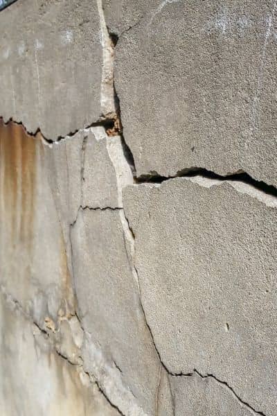
Some developers try to save time or money by skipping soil testing. In Grand Rapids, this often backfires. Here are a few issues that happen without testing:
- Basement flooding because groundwater wasn’t mapped correctly.
- Slab cracking when clay soils expand after heavy rain.
- Street or parking lot settlement in sandy soils without compaction data.
- Delays in site plan approval because reviewers request more data after submission.
In almost every case, the cost of repairs or delays ends up higher than the original soil test would have been.
How Soil Testing Ties Into Other Approvals
Soil testing doesn’t just help with foundations. It also links to other required permits and plans:
- Stormwater detention: Soil infiltration rates affect how ponds, basins, and outlet structures are designed.
- Erosion control: The Michigan Department of Environment, Great Lakes, and Energy (EGLE) requires Part 91 permits for soil disturbance. Testing provides the data for an effective erosion control plan.
- Grading plans: Soil stability guides how slopes are cut or filled. Poor grading without soil data can lead to slope failure.
Because of these connections, many projects can’t move forward without a soil report.
The Client Benefit: Saving Time, Money, and Stress
For property owners and developers, the benefits of soil testing are clear.
- Time savings: Submittals pass review faster when they include proper soil data.
- Cost control: Foundations are designed once and built right, instead of redesigned mid-project.
- Peace of mind: Owners know their buildings will stand strong against Michigan’s soil and water challenges.
In short, soil testing isn’t an added cost. It’s an investment in getting the job done right the first time.
Final Thoughts
Grand Rapids is a city that continues to grow, but growth comes with responsibility. Every new building, subdivision, or road depends on solid ground. Soil testing ensures the ground is ready. Without it, even the best design can fail.
If you’re planning a project—whether it’s a new home, commercial development, or infrastructure upgrade—don’t skip the soil test. It’s the first step to protecting your foundation, your budget, and your timeline.