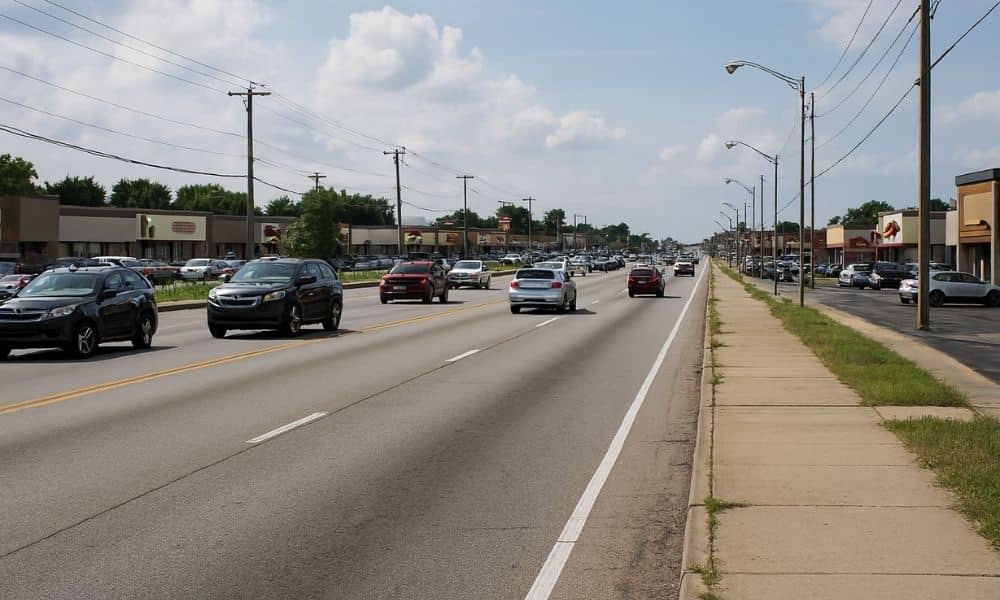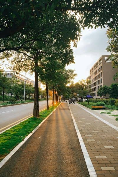
If you live in Grand Rapids, you already know the story of 28th Street. It’s wide, busy, and full of strip malls, driveways, and constant traffic. A recent post on r/grandrapids asked, “What if 28th Street looked like this?” sparking hundreds of comments. People argued about traffic, sidewalks, transit, and whether the corridor could ever feel safe and welcoming. That debate highlighted a deeper truth: urban planning shapes every part of our daily life, yet most of us only notice it when the system feels broken.
So why does a street like 28th look the way it does? And more importantly, why do redesigns take so long? The answer lies in the mix of codes, funding, and politics that sit behind every planning decision.
Why 28th Street Feels Hostile
First, let’s talk about the everyday experience. Driving down 28th, you face endless driveways. Each one invites a car to dart across lanes. Block lengths are long, which means fewer safe crossings for pedestrians. Cyclists have almost no protection, and the sidewalks—where they exist—often feel like an afterthought.
This setup didn’t happen by accident. Decades ago, planners focused on moving as many cars as possible. Shops wanted easy driveway access, so the corridor grew into a patchwork of curb cuts. The result is a street built for vehicles, not people. Today, that design feels outdated, but changing it is not as simple as painting bike lanes.
The Planning Puzzle
Here’s where things get tricky. A corridor like 28th Street is tied up in several layers of planning and regulation:
Form-based codes. These rules guide what buildings look like and how they interact with the street. If the city wants to change the feel of 28th, those codes have to be updated through a public process. That means hearings, approvals, and sometimes legal battles.
Access management. Engineers know too many driveways create chaos. Reducing them improves safety, but it also means negotiating with dozens of property owners. Few are eager to lose direct access to their businesses.
Right-of-way constraints. Space is tight. Stormwater pipes, utilities, and private property lines all box in any redesign. On a corridor as complicated as 28th, an accurate land survey often becomes the first step in figuring out what room planners really have to work with. It shows where the limits are, so the vision for wider sidewalks, new bike lanes, or stormwater fixes can be grounded in reality.
Multiple jurisdictions. 28th Street doesn’t sit under one agency. City planners, Kent County officials, and state transportation engineers all have a voice. With so many players, even small design changes can take years to sort out.
This maze explains why the community may dream of a greener, safer 28th, but the city can’t deliver change overnight.
What It Would Really Take
Imagine trying to remake 28th Street. The process starts with rewriting parts of the city’s planning code. That alone can take a year or more. Next comes the funding stack. Federal transportation grants, state allocations, and local matches all need to line up. Projects compete against others across Michigan.
Even with funding, construction must be phased. You can’t tear up the entire corridor at once. Property acquisition becomes another hurdle. If even a handful of owners push back, years can slip away in negotiations or court. And behind it all, engineers must solve stormwater challenges, rework signal timing, and design safe intersections.
When you add up each step, a major corridor project can take five to ten years from idea to ribbon cutting. That timeline frustrates residents who want faster change, but it reflects the reality of modern planning.
Lessons from the Reddit Debate
The Reddit thread showed two sides. Some users said, “Just add bike lanes and trees.” Others replied, “It’s not that easy.” Both are right. Yes, simple improvements like painted crossings or better lighting could help now. But meaningful change—like turning 28th into a people-first corridor—requires deep shifts in policy, funding, and design.
Urban planning is always a balance. Safety, mobility, property rights, and budgets collide. That’s why debates like the one online are so valuable. They reveal community priorities. Planners and engineers need that input before they redraw a street.
A Playbook for Corridor Change

So what can be done in the meantime? Small steps matter. Traffic studies can highlight safety hotspots. Driveway consolidation—working with willing property owners—can reduce conflict points. Stormwater retrofits, like bioswales, can fit even into tight spaces and improve drainage. Coordinated signal timing can smooth congestion.
None of these steps will make 28th Street the picture-perfect boulevard some Reddit users dream of. But they build momentum, show progress, and keep the bigger vision alive.
Why This Matters
28th Street is just one example, but the lesson applies citywide. From Division Avenue to Alpine, Grand Rapids faces corridors shaped by mid-20th-century car culture. Updating them demands patience, political will, and technical know-how.
For residents, it means understanding that change is possible, but it’s slow. For business owners, it means recognizing that safer, better-designed streets bring more customers. And for developers, it means planning ahead—because projects tied to corridor redesigns must navigate layers of codes, reviews, and approvals.
Closing Thought
Urban planning doesn’t happen on Reddit threads, but those conversations matter. They spark awareness, build pressure, and shape priorities. The debate about 28th Street proves people want more than just traffic flow. They want streets that feel safe, connected, and livable.
The next time you drive down 28th and wonder why it looks the way it does, remember: every curb cut, every signal, every missing sidewalk is a result of planning decisions. Changing that story takes more than paint—it takes vision, funding, and community persistence.
And maybe, just maybe, the conversation that started online can help finally move from frustration to transformation.